
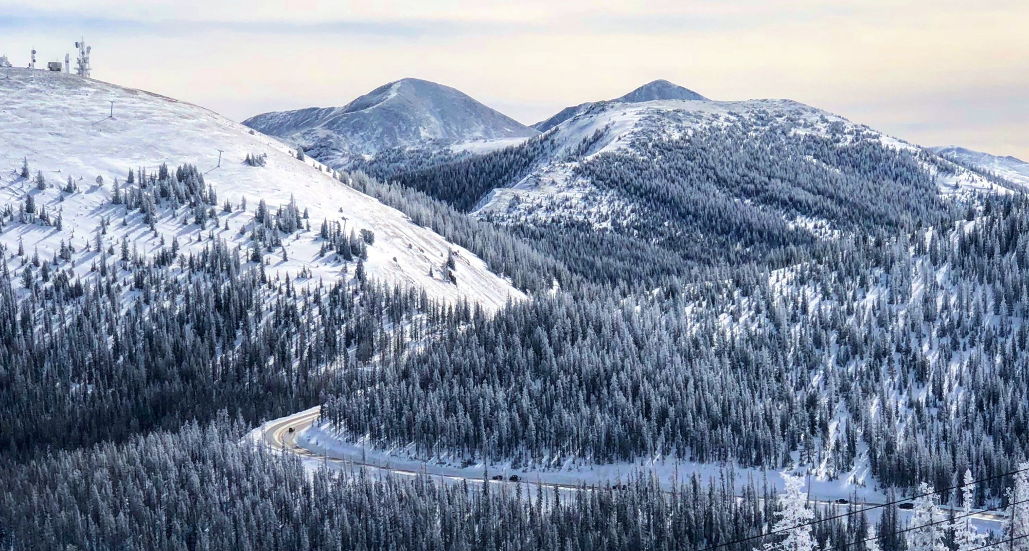
Welcome back to the fourth edition of The Mountains are Calling, Get There Safely. Throughout this series, we have been talking about options to get to the mountains without driving, prepping the car with items to have on hand, and gaining skills to be confident on the road. If you are just now finding this series, perhaps you might want to start your read back at The Mountains are Calling, Get There Safely – Alternatives to Driving. In this session, we will focus on the information we generally gather before we head to the mountain. This includes a few days ahead of time prepping with traffic forecasts, weather forecast, and avalanche risk. Once on the road, we keep checking on traffic with real-time traffic information and alerts.
Most of the time, we like to try to use I-70 for getting to the mountains as it has the more direct access and typically best snow and ice removal. If you are new to winter driving, I would suggest sticking to these roads for the time being until you are more confident. Once you get more proficient at mountain driving and comfort with going over mountain passes, we can talk about alternative routes like US-285. Don’t worry, we will include these in our next session. Unfortunately, I-70 is the antithesis of the road less traveled by so expect to deal a lot of other people heading this way, especially on the weekends.
 When traveling I-70, the basic rule of thumb to avoiding westbound traffic on a Saturday is to be past the Morrison exit 259 no later than 6 AM or wait until after 10 AM to head up. Eastbound heading back to Denver, leave the resort no later than 2 PM or wait until after 7 PM. Sundays tend to be a little lighter in traffic, but the general rule also applies. Key holidays such as Christmas, New Years, Martin Luther King Day, and Presidents Day create similar traffic and often worse traffic on Mondays. Another big attraction to plan around is the International Ice Sculptures in late January. If you can’t keep all this committed to memory, just remember the travel forecast on the goi70.com website. In addition to the details on the road, they have also curated a number of deals for lodging, dining, and relaxation help make passing time more enjoyable. One of the best is the Hot Tub Happy Hour special for $5 at the Breckenridge Recreation Center. While you are at it, check out our Save Some Dough – Aprés Ski or Soak for some additional ideas.
We rely on the weather forecast to determine if we are going and more importantly when we are going. Unfortunately, you can’t rely solely on the weatherman from the news outlets to give you information about your drive up. In fact, if you study the forecasts from the major news outlets from Denver, you’ll see the mountain towns presented change as the weather man or woman changes maps progresses throughout the forecast. Here’s an example from channel 9 weather, arguably the best forecasters in Denver. Not that we don’t trust their forecasts, we need details in specific spots and just like to dig deeper to be sure of what is going on.
 If you want more accurate details about travel, Joel Gratz and Sam Collentine from Open Snow dig through all of the available data out there and give you a great read out daily with The Colorado Daily Show and The I-70 Daily show. Primarily these forecastings are about where to find snow… but given the close proximity of some resorts to I-70, we can leverage for travel planning as well. Based on the details we get from these reports, we sometimes pull the snow forecast reports for Echo Mountain, Berthoud Pass, and Loveland Ski Area to give us an idea of what jams might happen as we head west. If there is a lot of snow falling at these 3 places, we expect road clearing delays at Floyd Hill and potentially road closures along US6 and US40. These 3 give us a good idea of 3 significant spots that cause delays between Denver and Summit County due to weather, namely Floyd Hill, Berthoud Pass, and Loveland Pass.
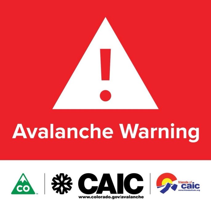
It’s also beneficial to look at the Colorado Avalanche Information Center (CAIC) to get an idea of the risk of avalanches along our route. The CAIC is a department of the Colorado Department of Transportation, and they not only serve the highway but backcountry enthusiasts. This is the go-to resource for Avalanche forecasting as well as details on incidents and why they happened. There is a ton of detail on this website and as we progress will refer to this site more and more. However, for the moment, we will just focus on the front page map that indicates what the level of risk and click into the zones of interest for a look at tomorrows forecast. For the I70 route we are talking about here, we will look at the Front Range zone as well as the Vail and Summit County zone. If the current conditions or forecast show considerable, there is a chance of a delay on the highway. If there is an extreme rating, there is are almost a guarantee of some delay.
 Lets put all of this together.
Leaving town on I-70 west of C470, you start at about 6000 ft elevation will gain nearly 1900 feet over the course of 12 miles. This is a big deal for most cars so don’t be surprised that your car struggles a bit and you hear it shift gears a lot as you climb. As you travel through you may notice the spaceship house on the left that was built for the Woody Allan movie Sleeper and just west of Genesee Park you will have a fantastic view of the continental divide looking west of Rollins Pass. If you took the train from Denver, this is where the famous Moffett tunnel cuts through. As you will continue around the bend, your car will appreciate a slight downhill before heading back up to Floyd Hill.
 Floyd Hill, named for the landowner that it originally crossed over, is the first significant terrain apex that you will crest along I-70 on your way to the high county at just over 7900′. On the back side of this hill, the road includes steep downhill grades, tight corners, narrow shoulders and limited sight distance. In about 2 miles, you have given back 600′ of the elevation. That’s steep! The route also traverses along North East exposure of Saddleback Mountain and, as a result, ends up being subject to icy conditions. To complicate things a bit further, its also where the highway reduces from 6 lanes to 4. Taken all together, this hill creates the first bottleneck in traffic. If there is weather affecting the front range, this hill quite often closes due to all the factors and accidents. Unfortunately, the last exit from the highway occurs a mile ahead of and around from the corner of the hill. As such, you can quickly get stuck here with no place to go for hours!
 You will proceed through the memorial tunnels and arrive at Idaho Springs. This is a quaint mining town under a fair amount of revitalization in recent years, and we are big fans of stopping here for dinner on the way up on a Friday night and occasionally on the way back on Sunday. It’s also an excellent place to stop and pick up any gear you may need at Feral Mountain’s new Idaho Springs store. These guys are great and also align with the prepare, progress, protect story that we promote here.
Its typically at this stop that we look at the current traffic conditions on Google maps to see if there are any red or black areas on the map. This information gets much harder to obtain as you go further up the canyon as the signal becomes less available. It’s also your chance to catch some side roads and bypass any jams. If you do decide to take the detour into Idaho Springs, the main road north out of town is called Colorado Boulevard. Just before it merges onto the highway, there is a road named Stanley on the left-hand side that becomes the frontage road alongside. I bring this route for two reasons. If you are nervous, this side road is well maintained and is a great way to get off the main highway and get rid of any aggressive drivers climbing up your tailpipe and two it a great way avoid expected backups along the next section of highway between Idaho Springs and the Empire US-40 turn off. Please note this is an access road for the locals, and the speed limit is well enforced.
If you decided to not catch the side road at Idaho Springs and start regretting it, your next chance to catch it about 6 miles up from Idaho Springs is the Downieville exit. In order to do this, head north off of the exit on the east side of the Interstate. Shortly out past the truck weigh station, this frontage road will turn slightly west and pass under the highway and through the residential area of Lawson. Just past the houses and before you go under the interstate a second time, you’ll need to come to a decision. If you want to continue to Winter Park keep straight back under the highway, and you will merge onto US-40. If you’re going to Summit County, turn left onto Alvarado Road to stay on the south side of the highway, and this will take you all the way into Georgetown. This will also bypass any mess if there are issues on Berthoud Pass.
US-40 carries a good percentage of ski traffic north to Winter Park, Granby, and Steamboat Ski areas. Unlike Floyd Hill, Berthoud pass does go through significant avalanche territory. The pass has limited passing and a lot of switchbacks. Unfortunately, other drivers tend to be aggressive on this route. If your not confident driving over a pass yet, we suggest avoiding Berthoud on the weekend. It just not the good place to learn. If the pass closes for an extended period of time during the morning hours, the backups can happen quickly. It can mess up traffic heading to these destinations as well as westbound traffic before the Empire turn off as well at exit 232. An extended closure on Berthod in the evening will divert traffic onto US-9 towards summit county side of the Eisenhower tunnel which will add to the volume heading East.
West of Empire, its 4 short miles to the town of Georgetown. For those of that have been traveling along via the frontage road, this is the end of the side road for a little while. Once you get the roundabout at the visitor center, you will have to get on the highway here. Georgetown also is another place to eat if you don’t mind a small detour to the downtown area a quick mile up the road.
Just up the hill from Georgetown is Silver Plume and as approach this town this is your last chance check the upcoming traffic and legally turn around. We recommend following CDOT on Twitter and their hashtag #I70West. We find this is the fastest way to get the latest road conditions, especially if coverage is limited. If there is a closure at the tunnel, its way better to wait it out in town vs. along the side of the road.
Georgetown to Silver Plume is a 700′ foot climb over 2 miles to just over 9100′ in elevation. Much like the earlier climbs in the trip, your car may have some struggles. Keep an eye out for large trucks as they definitely struggle and cause slowdown. Once at Silver Plume, you can again pick up the side road by driving straight at the end of the off-ramp on Silver Valley Road for more miles. Unlike the prior section of the side road, this is not well maintained and may not be plowed right away. It does, however, help avoid traffic when is awful. The Eisenhower tunnel as well as the turnoff for US6 is 6 miles ahead and will be the top of our elevation gain at just over 11000′, over 2 miles high. This is above treeline where avalanche risk generally is the most serious.
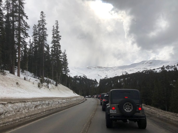 Likewise, US 6 also travels through notorious avalanche chutes which bear the name the Seven Sisters on the east side, and two chutes on the west side called the Professor and the Window Maker. If an avalanche chute is named, they are big deals and have a destructive history. If there is any notable avalanche risk for these chutes or mitigation activities in progress, Colorado Department of Transportation will close the pass. When this closes, all traffic is forced to go through the tunnel. This includes Hazmat vehicles which by the policy are only allowed to travel through the tunnel alone for safety reasons. This results in hourly closures, 15 mins at a time. When this happens, the backups can go on for miles.
If this wasn’t enough, I-70 itself is also subject to closure due to avalanche here at the tunnel. On the north side of the highway at the Eisenhower tunnel is Bethel Peak. This is the pointy mountain you see a few miles before the tunnel. When this slides, there can be enough snow to cover the interstate completely.
The Eisenhower Tunnel and lesser know Johnson Tunnel was built in the late 70s and keep a huge amount of traffic from having to go over treacherous US 6 over Loveland pass. The tunnel carves itself under parts of Loveland Ski Area which sits upward of 1500 feet over the top of the tunnels. We usually try to convince people riding with us to hold their breath through the 9000-foot long tunnel. At sea level, this might be possible, but the air is so thin up here it’s rare to have anyone make it all the way without gasping. At the far end of the tunnel, be sure to slow to more reasonable pace, but many of the other cars around us do not. Somehow people quickly forget in just over a mile and a half that road was icy! Over the next 10 miles, you will lose 2200′ to the exit in Silverthorne. Be aware of trucks with burning brakes. This is a lot of elevation for them to lose and if they weren’t careful, their ability to brake will be severely limited. Give the truckers space, they really appreciate it.
At the bottom of the hill, take exit 205 at Silverthorne to head south on US 6 to Keystone and Arapahoe Basin, continue 2 more miles to exit 203 at Frisco and head south on highway 9 in order to go to the Frisco Adventure Center as well as Breckenridge or stay on the Interstate 70 for seven more miles to arrive at Copper Mountain.
Just like the drive, this article was a long one. We are glad you make it through. At our next session, we will talk about mountain passes and how to not freak out when going over them. It’s really not as scary as it seems and can provide some amazing views.
Until then, pray for snow, and celebrate when Ullr Provides!
© 2018, UllrProvides All rights reserved. Any use or publication of content, including photos, requires express permission.
